Tilify Everything
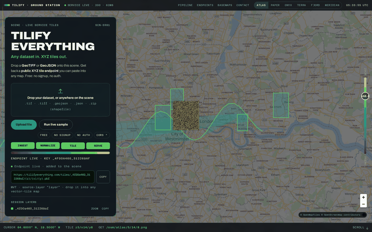
Any dataset in, map tiles out. Drop a GeoJSON, Shapefile or GeoTIFF onto the page and get back a public tile URL you can paste into any map — free, no signup, no auth.
Platform
tilifyeverything.com
What you get
Input formats: GeoJSON, Shapefile, GeoTIFF, COG
Public tile URL out, paste into any map
Ready-made basemap styles included
Signup, accounts or API keys
The problem
You have a geospatial dataset and a map to build. Between those two points sits a toolchain most teams don't keep on a shelf: specialist desktop software, one-off conversion scripts, a tile server to run, and usually a platform account with API keys and billing. Getting from "here's my data" to "here's a URL that serves map tiles" can burn days before any real work starts.
The solution
Tilify Everything collapses that whole path into a single step. Upload the file, receive a public tile endpoint for it. No account, no key, no billing page — and a built-in live sample means you can watch it work before you've decided to trust it. What used to be a tooling project becomes an upload.
What it does with your data
Two kinds of input go in, one kind of output comes out: a hosted tile URL that any standard mapping library can consume directly.
Vector data in, vector tiles out
Drop a GeoJSON or zipped Shapefile and receive a public vector tile endpoint with its usable zoom range — a URL you paste straight into a web map. Boundaries, roads, points, polygons: if it draws as a shape, it ships as tiles.
Raster data in, image tiles out
Upload a GeoTIFF or cloud-optimized GeoTIFF — elevation models, drone imagery, climate grids — and get back rendered image tiles served on demand at every zoom level. The heavy file stays put; your map just requests the pixels in view.
Six basemap styles, included
Every layer deserves a backdrop, so six curated basemap styles ship with the service — from light cartographic looks for reports to dark tones for dashboards. Your data layers and the basemap come from one place, under one consistent URL scheme.
Paste it into whatever you already use
The endpoint speaks the standard tile protocol every mapping tool understands — web libraries, desktop GIS, even a plain command line. Open cross-origin access means no proxy, no plugin, no adapter: the URL works the moment you paste it.
Why it matters
For builders
- Days of toolchain setup replaced by a single upload — the endpoint arrives ready to paste
- Zero procurement friction: no signup, no API key, no billing discussion before you can evaluate
- Try before you commit anything — a built-in live sample runs the full flow in one click
- Standard protocol output, so it slots into the map stack you already have
For the business
- Frees specialist geospatial staff from running commodity tiling infrastructure
- Removes the account-and-key barrier that stalls proof-of-concept work with external data
- One uniform endpoint surface for vector, raster and basemap layers — less to document, less to maintain
- Free public service: predictable cost of exactly zero for evaluation and light production use
Your dataset, on a map, today
Upload a file, get a tile URL, paste it into your map. Free, no signup, no auth — or run the live sample and watch it happen first.
Try Tilify Everything